Route 66 Tour, Day 13 – In California
Yesterday was a pretty tough day driving. We had to travel from Williams, Arizona (about 1/3 of Arizona left to traverse) to Victorville, California (most of which is across desert). As we traveled through the day, the temperature kept climbing – I believe it topped out at 127 degrees at one point.
We stopped off in Seligman, Arizona and met Angel Delgadillo, one of the icons of Route 66. Angel has owned a Barbershop on Route 66 for decades, nearby is the Snowcap restaurant that his brother Juan owned. The town of Seligman is one of the first to start to preserve the history of Route 66, which is why in western Arizona, the Mother Road is meticulously taken care of and well marked.
We made a couple more stops at some old gas stations – one in Hackberry, which is basically a ghost town now except for a General Store, and one in “Cool Springs” that was anything but “cool” – this is where we really started noticing how seriously hot the weather was and the VWs were noting the exterior temperature of over 110 degrees. Cool Springs was an important stop for early Route 66 travelers before the next leg of their trip. For many years, it was a ruin, but has now been restored.
The Oatman Highway and Sitgreaves Pass through the Black Mountains from Kingman into California – what can I possibily say about it? Oh, a lot.
First read a bit about it:
There are two Route 66 alignments from Kingman southwest to the California border. The pre-1952 alignment along the Oatman Highway is by far the most beautiful, providing numerous photographic opportunities, legendary Route 66 icons, and a peek at the wild old west in historic Oatman, Arizona.
However, this old route travels through notorious Sitgreaves Pass, the most intimidating portion of Route 66, with its steep grades, narrow road, and sharp hairpin curves. In addition, the highway does not allow vehicles over 40 feet, so, if this is you, think about coming into Oatman from the south through Topock, an easier route.
This is the section of road featured in the Lucille Ball/Desi Arnaz movie called “The Long, Long Trailer” – where they drive over it in an RV, ironically, that’s illegal to do.
Update: after googling, this isn’t road from the movie – someone told us that along the way, but it was actually another road in California.
I had no idea what we were going to drive through. Nine miles of winding road up the Black Mountains and back down, with sheer cliff drops on the right side of the road. Gorgeous, and very very difficult to get through, even at 15 miles an hour. The rest of the caravan was ecstatic to be on it; we were terrified. I’ll try to do a google map image of it from above if I can do it through my cell phone internet connection (still no wireless at the Motel 6, even near L.A.) ; it is pretty amazing. Here’s a pretty good image of part of it, from this link.
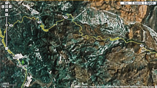
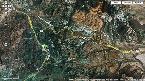
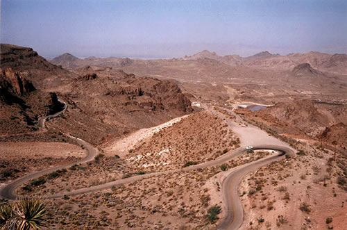
And something I will never, ever be doing again. Between the Grand Canyon and this, I believe I’m also finished with rollercoasters, too. What was I saying the other day – I grew up in Iowa, where it’s nice and flat, and you can’t fall off things?
At the bottom is the little town of Oatman, Arizona – a tourist spot that still resembles the Old West mining town that it once was. Back in 1939, Clark Gable and Carole Lombard spent one of their honeymoon nights in the 1902 historic Oatman Hotel. They are also famous for the burros that hang out in the streets (And follow you around, hoping you have carrots.)
After a few minutes shopping and recovering from the Sitgreaves Pass experience, we headed out towards Needles, California.
Just as we were getting into Needles, California, Earl’s car started to have serious problems. We pulled into a 76/Conoco station so the guys could try to figure out what was wrong, and the manager ran us off because he thought we were interferring with his business. So we moved to the snow cone shop across the street, and they were kinda crabby with us, too. Eventually some of us had to park our cars at the Jack-In-The-Box across the street and get in out of the heat.
After an hour and a half, the guys got the car fixed, and we got back on the road – we still had about 2 and a half hours of driving to get to Victorville, and we were a bit behind. The rest of the drive was pretty uneventful, but tiring. Once the sun went down it was a bit easier to travel, but the beginnings of L.A. traffic driving into Victorville – we’re really nervous about getting around today.
Seligman, Az
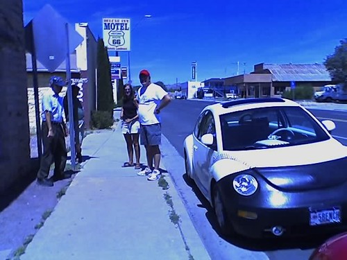
Angel Delgadillo, owner of Angel’s Barbershop and Route 66 icon, is on the left, Jerry and Kathy are showing him Homer the baseball beetle. He was tickled pink with it. Homer got lots of attention everywhere we went.
Pittsburg, Kansas
We made our way across Missouri today, and into the eastern edge of Kansas, where my aunt Susan and uncle Ron live, with their kids. Sarah is the one getting married tomorrow. Today we photographed:
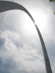
1. The Gateway Arch in St. Louis (we went up in it!)
2. A giant baseball (we stumbled on this one, so not a great picture.)
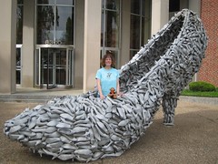
3. A giant shoe, made of shoes (in front of a shoe company, of course.)
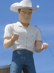
4. A giant Muffler-man style cowboy
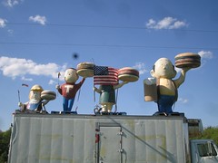
5. An entire A and W Root Beer Family. (Very rare!)
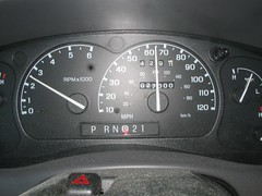
5a. My truck turning 27,000 miles
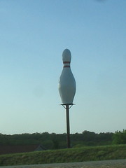
6. A giant bowling Pin
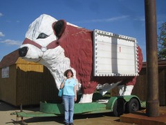
7. A giant cow at the Mule Trading Post (we stumbled on it while charging my camera battery.)
8. A giant Dinosaur near Exit 130 on I-44 (visible from the road!)
(Photo eventually, sorry.)
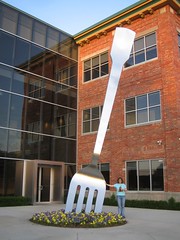
9. A giant Fork near Springfield, Missouri (it’s still there, DocLarry, just near an ad agency now.)
Photo Set: Kansas Road Trip so far. (Includes way more photos than what I posted here.)
St. Louis
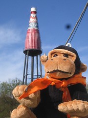
So we found the giant catsup bottle in Collinsville, Illinois (hmm. They have lots of “l”s in their name). I have photos to upload of that shortly.
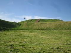
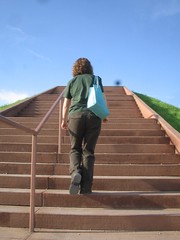
Then we headed further towards St. Louis, intending to find a hotel and restaurant, then head out to find a couple of big things. But we noticed a giant hill off of I-70, and realized it was an indian burial mound. So we hopped off the nearby exit, and found our way to the Cahokia Mounds State Historic Site, which was incredibly beautiful. It helped that we had bright sunshine in the late afternoon, while we climbed up Monk’s Mound, the largest of the many mounds on the site. We took lots of great pictures.
Just west of the site was Woodhenge, a reconstruction of a large ancient calendar that stood on the spot, made of cedar poles set in a ring 400 feet across, with a pole in the center. We walked to the center pole, and the shadow lined up with the pole directly in line with Monk’s mound. It was pretty cool.
Then we headed into St. Louis to look for a hotel. We opted to look on the west side of town near I-44, which we’ll be taking through the rest of Missouri. We drove through a beautiful section of town called Webster Groves, which had some really huge historic houses. Very nice. We eventually found Pear Tree Inn, and had dinner at the Bandana’s Barbecue next door. It’s obviously a chain, but we’ve never been, so it was fun.
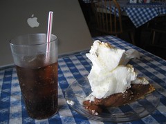
Foot High Pies
We’re stopping at the Blue Springs Restaurant near Highland, Illinois, because they advertise foot-high pies. And we discovered they have free wifi at this gloriously gingham-bedecked country-fied cafe. They also offer “Ho-made” pork sausage and “Ho-made” mashed potatoes. I didn’t realize hos were such good cooks. We took pictures of the foot-high pies (whose towering height is mostly due to meringue) and now we’re splitting a piece of chocolate and blogging our trip so far.
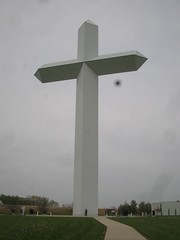
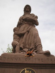
We stopped at the Giant Cross at Effingham, and also jumped off 70 at Vandalia, the old state capitol to take a pictures of the Madonna of the Trail statue at Illinois’s old state capitol.
After this, we’re off to find a giant bottle of catsup.
