1898 Sanborn Map of 2165 N. Penn
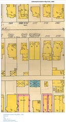
Sanborn maps were fire insurance maps that showed neighborhoods and houses for the purposes of determining insurance rates. This is the 1898 map of my neighborhood, showing my house as it looked at that time. I used to have a wrap-around front porch. There also appears to have been a stable on the property.
See the picture on Flickr.